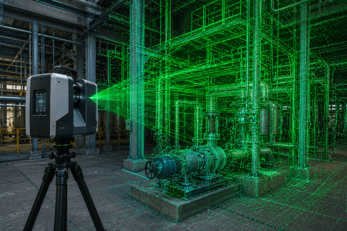
Turn captured site conditions into usable spatial data for engineering, construction, and asset management projects. Terrestrial laser scanning captures detailed 3D measurements of buildings, industrial plants, and existing assets to create accurate point cloud data. AUAV provides terrestrial laser scanning and spatial-data services for engineering, construction and industrial asset projects across Australia.
What Is Terrestrial Laser Scanning?
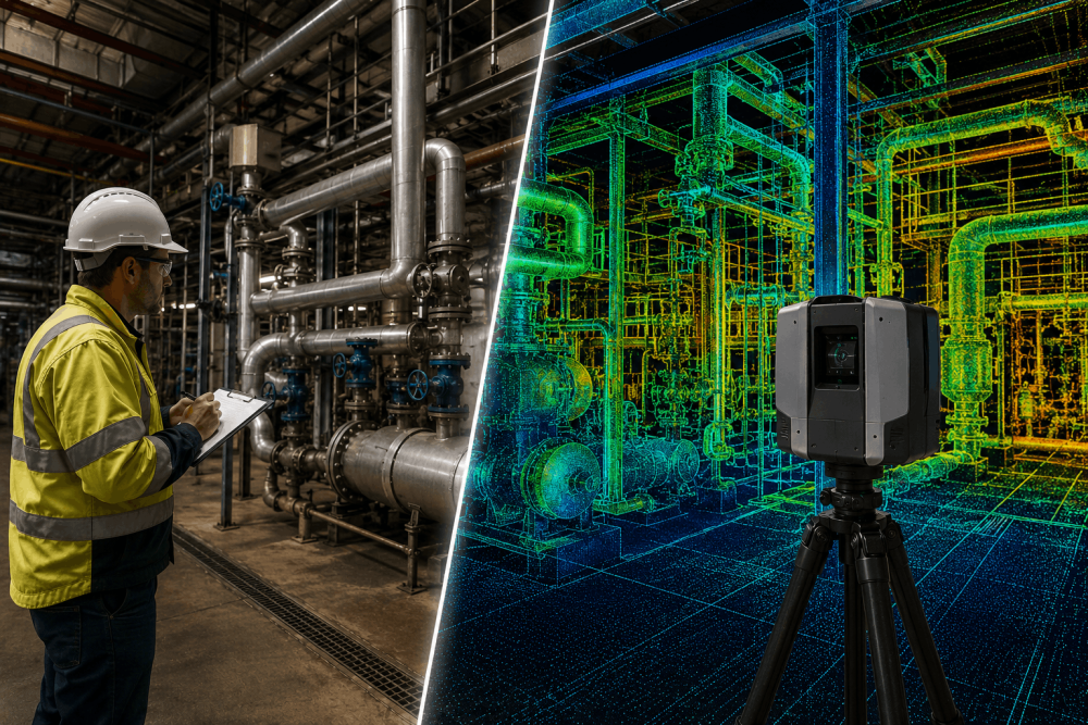
Terrestrial laser scanning uses a ground-based laser scanner to capture measurements of surrounding surfaces. The collected measurements form a dense three-dimensional data set known as a point cloud. Multiple scan positions can be registered together to represent larger or more complex environments. Depending on the project scope, this data can then support measurements, drawings, 3D models, and other engineering or asset information requirements.
3D terrestrial laser scanning is useful when a project requires detailed spatial data from an existing building, industrial facility or complex asset. It creates a measurable 3D record that can support as-built documentation, engineering, design coordination, modelling, and future asset planning.
But what happens when the site has changed since those drawings were produced, the geometry is complex, or thousands of individual measurements would be required? This is where terrestrial laser scanning services can provide project teams with a detailed digital representation of existing conditions.
How Does a Terrestrial Laser Scanning Project Work?
1. Define requirements
Confirm the area to be scanned, required accuracy and intended deliverables.
2. Plan site capture
Determine scanner positions, site access and any operational requirements.
3. Capture scans
Collect spatial measurements from the required locations.
4. Register point clouds
Combine individual scans into a coordinated point cloud dataset.
5. Quality-check data
Review the captured and registered information against project requirements.
6. Produce deliverables
Prepare the agreed point cloud, CAD drawings, 3D models or as-built information.
When Should You Use 3D Terrestrial Laser Scanning?
1. When Existing Drawings Cannot Be Relied On
Older buildings and industrial facilities often change over time. Equipment may have been replaced, structures modified or services rerouted without every change being reflected in the original documentation.
Scanning the current environment provides project teams with an up-to-date spatial record before new design or engineering work begins.
2. Before Refurbishing or Extending an Existing Building
Refurbishment projects depend heavily on understanding what is already there.
Architects, engineers and construction teams can use laser scanning to document walls, structural elements, services and other existing features. This can provide better source information for design development and reduce reliance on assumptions or isolated measurements.
3. When Capturing Complex Plant and Pipework
Industrial facilities can contain dense combinations of pipework, vessels, structural steel, platforms and equipment.
Capturing every relevant feature through individual measurements can be difficult. 3D terrestrial laser scanning allows a much denser spatial record of complex areas to be captured for subsequent engineering and design use.
This makes the technology particularly relevant to plant upgrades, brownfield modifications and industrial asset projects.
4. When Accurate As-Built Documentation Is Required
As-built information records the physical conditions of an asset rather than relying solely on its original design documentation.
Laser scanning can capture existing geometry for use in as-built workflows, including plans, sections and models where these form part of the agreed deliverables.
Project Insight: A laser scan does not automatically produce a finished engineering drawing or BIM model. The point cloud is the captured spatial dataset. The required drawings, models or other outputs are then produced from that information according to the project scope.
5. When Your Team Needs Point Cloud, CAD or 3D Data
One advantage of laser scanning is that the captured information can support several downstream workflows.
|
Potential Output |
Typical Project Use |
|
Registered point cloud |
Existing-condition reference and measurement |
|
2D plans and sections |
Design and project documentation |
|
3D model |
Engineering and design coordination |
|
As-built information |
Asset records and verification |
|
Spatial measurements |
Dimensional assessment |
The exact deliverables should always be agreed before scanning begins.
6. When Conventional Measurement Requires Difficult or Repeated Access
Some sites are large, congested or operationally complex. Returning repeatedly to obtain missed dimensions can affect project schedules and site access requirements.
A well-planned scan can capture dense spatial information during the fieldwork phase, allowing project teams to interrogate the resulting point cloud later for information contained within the captured dataset.
7. When You Need a Digital Record for Future Asset Decisions
Laser scanning is not limited to immediate design work. A captured dataset can also provide a digital reference for future modifications, maintenance planning and asset documentation.
When combined with other drone asset inspection and spatial-data workflows, it can contribute to a broader digital record of an asset.
Need an accurate digital record of your existing asset?
Whether you’re planning a plant modification, refurbishment, engineering project or need reliable existing-condition data, it’s worth exploring AUAV’s terrestrial laser scanning services.
Terrestrial Laser Scanning vs Traditional Site Measurement
Neither approach is automatically better. The appropriate method depends on the project, required accuracy, site conditions and intended output.
|
Project Requirement |
Traditional Measurement |
Terrestrial Laser Scanning |
|
Selected dimensions |
Well suited |
Can capture these within broader scan data |
|
Complex geometry |
May require many individual measurements |
Dense 3D spatial capture |
|
Existing-condition record |
Selected measurements |
Detailed point cloud |
|
Large plant environments |
Multiple measurement locations may be needed |
Multiple scans can form a registered dataset |
|
Future measurement queries |
Another visit may be required |
Existing scan data may contain the required information |
|
3D workflows |
Measurements need further conversion |
Point cloud can support 3D modelling workflows |
What to Look for When Choosing Laser Scanning Services in Australia
When comparing laser scanning services in Australia, do not assess providers solely on scanner specifications. The quality and usefulness of the final information also depend on how the project is planned, captured, registered, processed and delivered.
Before requesting a quote, we recommend clarification on following points.
- What needs to be scanned?
- What will the data be used for?
- What accuracy or level of detail is required?
- What final deliverables does your team need?
- Are there site access or operational restrictions?
- When is the information required?
Clear answers help determine the appropriate scanning methodology and project scope.
Frequently Asked Questions
How accurate is terrestrial laser scanning?
There is no single accuracy figure that applies to every Terrestrial Laser Scanning project. Results can depend on the equipment, scanning distance, site conditions, survey control, registration methodology and required deliverable. The provider should establish the project’s accuracy requirements before fieldwork and plan the capture methodology accordingly.
How long does terrestrial laser scanning take?
The time required depends on the size and complexity of the site, required coverage, access conditions, number of scanner positions and project deliverables. A relatively contained area may require far less field time than a complex industrial facility. Data registration, processing and production of agreed outputs also need to be considered.
Can terrestrial laser scanning create as-built drawings?
Laser scanning can provide the spatial data used to develop as-built documentation. The scanner creates a point cloud representing captured existing conditions. Depending on the agreed scope, this information can then support 2D plans, sections, measurements or 3D models. Finished documentation requires appropriate processing after site capture.
How much does terrestrial laser scanning cost?
Terrestrial laser scanning costs vary depending on site size, complexity, access, required accuracy, and final deliverables. As every project has different requirements, the scope should first be assessed before an accurate and appropriate quotation can be provided.
What is the difference between LiDAR and terrestrial laser scanning?
LiDAR is a measurement technology that uses laser pulses to determine distances. Terrestrial laser scanning is a ground-based application of laser scanning technology used to capture detailed 3D information about buildings, structures, industrial assets and other environments. LiDAR can also be deployed from airborne platforms for larger-scale mapping applications.
Planning a project?
Book a consultation with team AUAV about your site, required outputs, and scanning requirements.