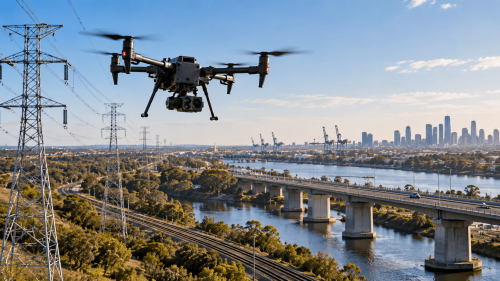
Drone infrastructure inspections use unmanned aircraft equipped with cameras and specialist sensors to assess the visible condition of utility assets. They support power line inspections, asset documentation, and maintenance planning while reducing some difficult-access requirements.
Utility infrastructure extends across cities, industrial facilities, remote landscapes, and difficult terrain.
Inspecting these assets regularly is essential for identifying deterioration, understanding asset condition, and planning maintenance.
Utility drone inspections provide an additional method for collecting detailed visual information without requiring personnel to physically access every structure.
What Are Drone Infrastructure Inspections?
Drone infrastructure inspections involve using unmanned aerial vehicles (UAVs) to examine assets from carefully planned positions.
High-resolution cameras, thermal sensors, and other specialist equipment can capture information that supports condition assessments.
For electric utilities, common inspection targets include:
Transmission towers and structural connections.
Distribution poles and crossarms.
Conductors, insulators, and associated hardware.
Substation structures and selected equipment.
Vegetation near power line corridors.
The appropriate sensor and inspection method depend on the asset, operating conditions, and required findings.
How Do Drones Improve Power Line Inspections?
Traditional power line inspections may involve ground crews, elevated access equipment, or helicopters.
Drones offer another option for inspecting selected assets, particularly where direct access is difficult.
Three Practical Benefits for Utility Operators
1. Detailed visual documentation
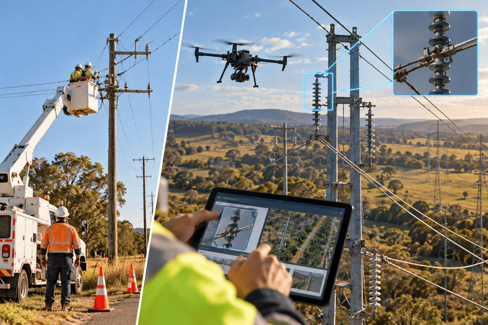
High-resolution imagery can reveal visible corrosion, damaged hardware, cracked components, and other observable anomalies.
2. Reduced exposure to difficult-access tasks
Remote imaging can limit the need for personnel to approach certain elevated structures or challenging terrain.
3. Better maintenance planning
Georeferenced photographs and consistent inspection records can help maintenance teams identify locations requiring further investigation.
These benefits depend on flight conditions, image quality, safe operating distances, and inspection procedures.
Where Can Thermal Drone Inspections Add Value?
Thermal drone inspections measure infrared radiation to visualize temperature differences across equipment surfaces.
For suitable electrical assets, thermal imaging can help identify unusual heating patterns that may warrant investigation.
Potential applications include:
Identifying apparent hot spots around accessible electrical connections.
Examining selected substation components.
Supporting targeted follow-up inspections.
Comparing thermal observations during repeat assessments.
However, a thermal anomaly does not automatically confirm an electrical fault.
Equipment loading, environmental conditions, surface properties, and camera settings influence thermal readings.
Can Drone Inspections Support Vegetation Management?
Vegetation encroachment can create operational concerns for overhead utility networks.
Drone mapping and LiDAR can support vegetation assessments by providing spatial information about trees, structures, and surrounding terrain.
Depending on the survey approach, these datasets may help utilities identify areas requiring closer vegetation clearance assessment.
For reliable results, the survey must account for conductor geometry, data accuracy, and applicable clearance requirements.
What Should a Utility Drone Inspection Report Include?
An effective utility asset inspection should produce information that maintenance and engineering teams can use.
Useful deliverables may include:
Georeferenced photographs of inspected assets.
Identified visual anomalies and their locations.
Thermal imagery where appropriate.
Inspection coverage and limitations.
Structured records for asset management systems.
Where required, 3D mapping can provide additional spatial context for infrastructure corridors and surrounding terrain.
The report should distinguish observable defects from issues requiring specialist testing or engineering assessment.
What Should Utilities Consider Before Commissioning Drone Inspections?
Successful inspections require a clear scope and appropriate operational planning.
Utility operators should establish:
Asset types and inspection priorities.
Required image detail and sensor capabilities.
Site access and electrical safety restrictions.
Weather conditions and operational constraints.
Data security, reporting formats, and integration needs.
In the United States, commercial drone operations generally fall under FAA Part 107, with additional authorization or operational requirements applying in certain circumstances.
Utility owners must also coordinate flights around energized infrastructure and restricted facilities.
Plan Your Utility Inspection Program with AUAV
Reliable infrastructure monitoring starts with consistent data collection and clearly defined inspection objectives.
AUAV provides specialist drone inspection and geospatial solutions for infrastructure and asset management applications.
Need to assess transmission towers, distribution poles, or other utility assets?
Contact AUAV to discuss your inspection scope, site conditions, sensor requirements, and reporting needs.
Frequently Asked Questions
1. What utility infrastructure can drones inspect?
Utility drone inspections can assess accessible transmission towers, distribution poles, insulators, conductors, and selected substation equipment. The inspection approach depends on asset geometry, operating conditions, required detail, and safe flight distances.
2. Can drones detect faults in electrical equipment?
Thermal drone inspections can reveal abnormal temperature patterns that may indicate potential equipment issues. However, confirming electrical faults requires appropriate interpretation, operating context, and sometimes additional testing by qualified specialists.
3. Are drone inspections safer than traditional utility inspections?
Drone infrastructure inspections can reduce some working-at-height and difficult-access exposure. However, flights near energized assets introduce operational risks that require suitable equipment, trained personnel, safe distances, and site-specific procedures.
4. How often should utilities conduct drone inspections?
Utility drone inspection frequency depends on asset condition, operational risk, environmental exposure, maintenance policies, and applicable requirements. Utilities should establish inspection intervals based on engineering priorities rather than a universal schedule.
5. What affects the cost of utility drone inspections?
Utility drone inspection costs vary with asset quantity, location, accessibility, sensor requirements, flight restrictions, data processing, and reporting complexity. A clearly defined scope helps providers prepare meaningful project-specific quotations and schedules.