
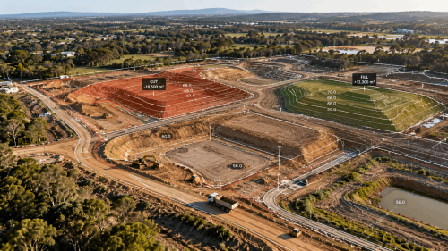
Earthwork can involve a lot of material, equipment, and movement across a construction site. If the estimated quantities are off, the impact can extend to excavation, trucking, equipment use, schedules, and overall site preparation.
This is where accurate cut and fill calculations become important. They show where material needs to be removed and where it needs to be added to achieve the planned site levels.
With 3D mapping, construction teams can capture the existing terrain in detail and compare it with the proposed design surface. This gives them a clearer picture of the earthwork involved before and during construction.
What Are Cut and Fill Calculations?
Cut and fill calculations are used to work out the amount of material that needs to be removed or added across a site.
The term cut applies to areas where the existing ground is higher than the required elevation. Fill applies where the ground needs to be raised.
These calculations can be useful when planning:
- Excavation and grading.
- Material movement and reuse.
- Site preparation.
- Earthwork quantities.
- Progress and project reporting.
The basic principle is simple, compare the existing ground with the required design level and calculate the difference between the two.
How Can 3D Mapping Improve Cut and Fill Accuracy?
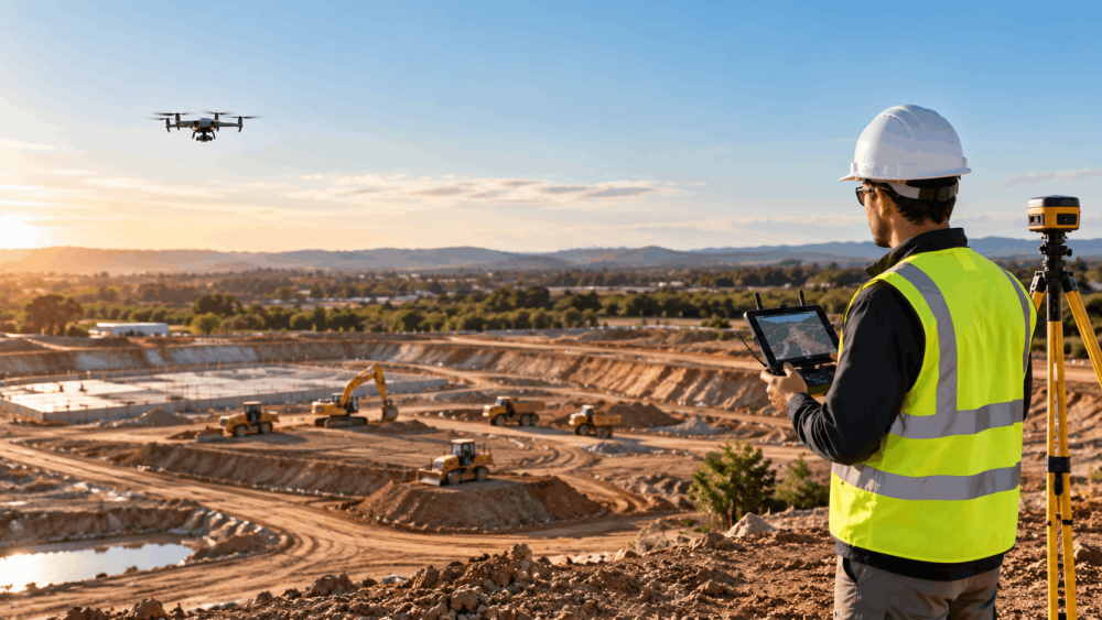
The calculation is only as good as the site data behind it. A detailed ground representation can give construction teams a better starting point than limited measurements or assumptions about what the terrain looks like.
The 3D mapping produces a digital surface of the site that can be measured and compared to the proposed design. Differences between the two surfaces indicate where excavation or additional material may be required.
This comparison can also highlight differences between actual site conditions and the planned surface. Finding those differences earlier gives the project team an opportunity to address them before a large amount of earthwork has taken place.
Why Accurate Earthwork Calculations Matter
A small change in elevation may not seem significant on its own. Across a large site, however, those differences can add up to substantial volumes of material.
That can affect how much material needs to be excavated, transported, reused, or brought onto the site. It can also influence equipment requirements and the timing of earthwork activities.
Accurate earthwork volume calculations can help with:
- Estimating material quantities.
- Balancing cut and fill.
- Planning grading work.
- Comparing existing and proposed surfaces.
- Recording changes during construction.
Having reliable quantities also gives contractors and other project stakeholders a consistent set of data to work from.
Can 3D Mapping Help Track Earthwork Progress?
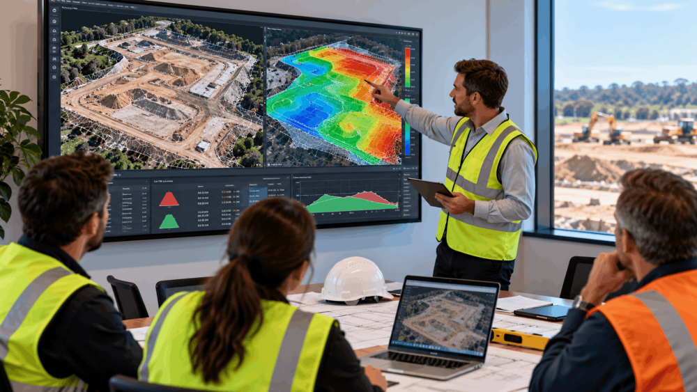
Construction 3D mapping does not have to be limited to the beginning of a project. The site can be mapped again as earthwork progresses, creating a series of datasets that show how conditions have changed.
For example, a current site surface can be compared with an earlier survey or the original design surface. This can show where grading work has been completed and where further work remains.
For project managers, this provides a more measurable way to review construction progress monitoring rather than relying only on visual checks from the ground.
What Data Is Used for Cut and Fill Calculations?
There is no single data format used for every project. The required output depends on the site, project specifications, accuracy requirements, and how the information will be used.
Geospatial mapping can produce several types of data for earthwork applications, including:
- Point clouds.
- Digital terrain models.
- Elevation models.
- 3D surfaces.
These datasets provide different ways of representing the terrain and can be used as part of the process of comparing existing conditions with the proposed design.
The data collection and processing approach should be selected based on the requirements of the project rather than simply choosing a particular output because it is commonly used.
Turn Earthwork Data Into Better Decisions
Good earthwork planning starts with knowing what is actually on the site. Cut and fill calculations provide the quantities, while detailed terrain data gives those calculations a clearer basis.
Together, they can support decisions around material movement, grading, resource planning, progress checks, and project reporting.
Planning earthworks or need reliable volume data? Talk to AUAV about 3D mapping and geospatial solutions tailored to your construction site’s accuracy, deliverable, and reporting requirements.
FAQ
How are cut and fill calculations performed?
Cut and fill calculations compare the existing ground surface with the proposed design surface. Where the existing ground is higher than the required elevation, the difference is classified as cut. Where it is lower, the difference represents fill. These differences are measured across the site to estimate the volume of material involved.
How does 3D mapping help with earthwork calculations?
3D mapping provides a detailed digital representation of the existing terrain. That surface can be compared with a proposed grade or design surface to identify elevation differences and calculate material volumes. The resulting information depends on the quality of the captured data, processing, survey controls, and project requirements.
Why are accurate earthwork volume calculations important?
Accurate earthwork volume calculations give construction teams a better idea of how much material may need to be excavated, reused, transported, or imported. These quantities can feed into decisions about equipment, scheduling, material handling, budgeting, and progress reporting.
Can 3D mapping for construction monitor earthworks over time?
Yes. 3D mapping for construction can be repeated throughout an earthwork project. Comparing datasets from different stages can show how the site’s terrain has changed and provide a record of completed grading work. This can also help project managers compare actual conditions with earlier surveys or planned surfaces.
What is the difference between cut, fill, and balanced earthworks?
Cut means removing material from areas that sit above the required elevation. Fill means adding material where the ground needs to be raised. Balanced earthworks involve using suitable material removed from cut areas to fill other parts of the same site, rather than importing additional material or sending excess material off-site.
What information is needed for accurate cut and fill volumes?
Accurate cut and fill volumes generally require reliable existing-ground data and a proposed design or grading surface. Other factors can include the site’s conditions, survey controls, required accuracy, project specifications, and the way the data is captured and processed. The required workflow should be based on what the project needs the final information to show.