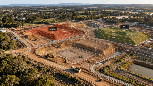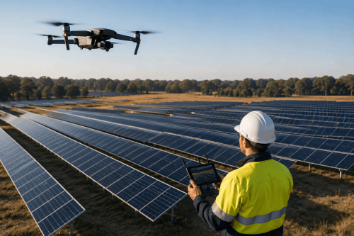
Drone surveying uses drones, high-resolution sensors, and geospatial technology to collect accurate site data from the air. For US construction and infrastructure projects, it can support faster mapping, safer data collection, progress monitoring, and better project decisions.
Construction and infrastructure teams need reliable site information without creating unnecessary delays or safety risks. Drone surveying provides a faster way to capture detailed aerial data across construction sites, transportation corridors, utilities, and other large assets.
But what exactly does a drone survey provide, and when should you use one?
What Is Drone Surveying and How Does It Work?
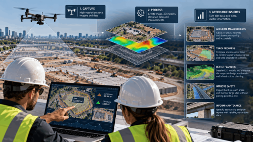
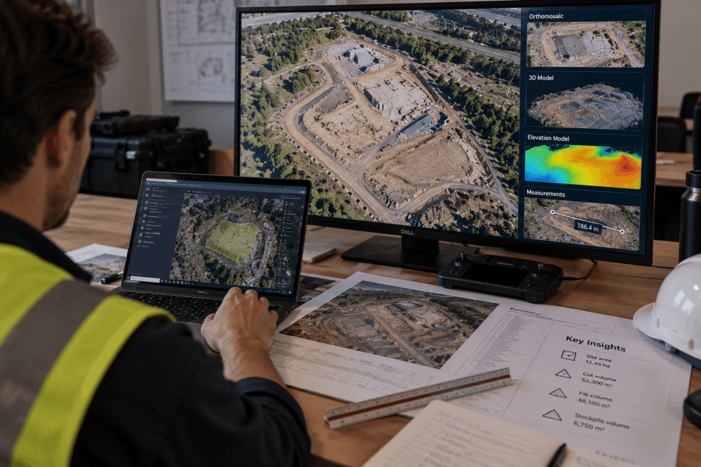
Drone surveying involves flying an unmanned aircraft over a site to collect high-resolution imagery or other geospatial data. The captured information can then be processed into accurate maps, models, measurements, and other project deliverables.
Depending on project requirements, drone mapping services can produce:
- Orthomosaic maps
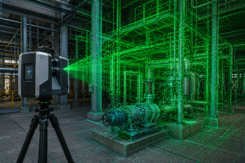
- 3D models and point clouds
- Digital elevation and surface models
- Contours and volumetric measurements
- Progress imagery and site documentation
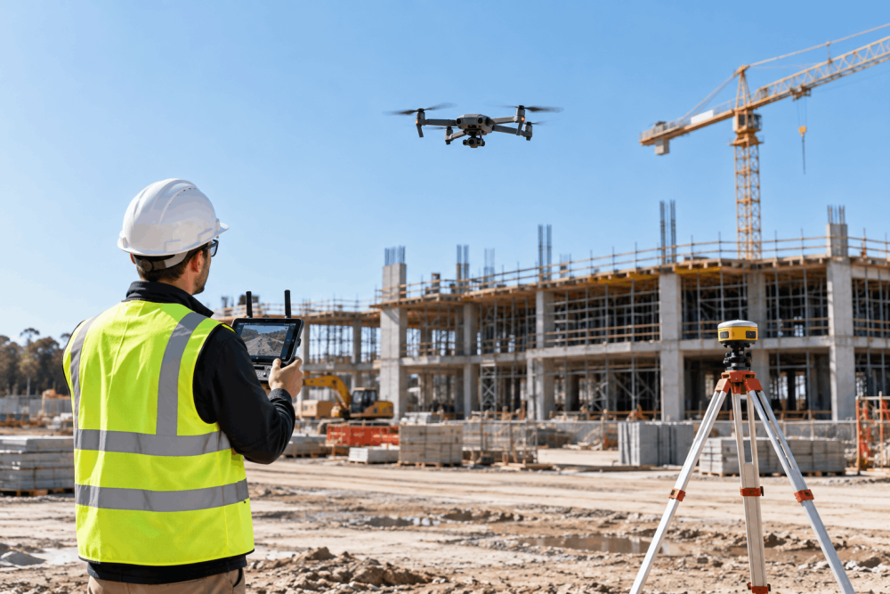
Why Use Drone Surveys for Construction Projects?
Traditional field data collection can require personnel to spend significant time moving around active or difficult-to-access sites. Drone surveying services can capture extensive areas from the air while reducing unnecessary exposure to site hazards.
For construction teams, this can mean faster access to current information for planning, earthworks, progress monitoring, and stakeholder reporting.
The result is not simply more imagery. It is better visibility into what is happening across the project.
How Does Aerial Mapping Support Infrastructure Projects?
Large infrastructure projects can extend across considerable distances and complex terrain. Aerial surveying services make it possible to efficiently document these environments and create consistent datasets for project teams.
Applications can include:
- Roads and transportation corridors
- Utilities and energy infrastructure
- Civil construction projects
- Land development
- Asset and site monitoring
Regular drone mapping can also create a historical visual record, helping teams understand changes between different stages of a project.
How Accurate Is Drone Surveying?
The accuracy of a drone survey depends on factors including equipment, flight planning, site conditions, positioning methods, ground control, processing workflows, and the accuracy required for the final deliverable.
This is why professional geospatial services matter. Collecting aerial images is only one part of the process; producing reliable project information requires appropriate survey methodology, quality control, and experienced data processing.
Is Commercial Drone Surveying Regulated in the US?
Yes. Commercial drone operations in the United States are regulated by the Federal Aviation Administration (FAA), and many operations fall under Part 107 requirements.
Working with an experienced drone surveying company helps ensure that flight planning, operating requirements, data capture, and project deliverables are handled professionally.
Turn Site Data Into Better Project Decisions
From initial site documentation to ongoing construction monitoring, drone surveying in the USA can help project teams collect information efficiently and turn complex sites into clear, usable geospatial outputs.
Need accurate aerial data for your next project?
Contact AUAV to discuss professional drone surveying, mapping, and geospatial solutions for your site!
Frequently Asked Questions About Drone Surveying
How much does drone surveying cost in the US?
The cost of drone surveying varies according to site size, location, airspace, terrain, required accuracy, flight complexity, and final deliverables. A straightforward aerial mapping project can have very different requirements from a large infrastructure survey involving detailed 3D models, elevation data, or repeated project monitoring.
How long does a drone survey take?
A drone survey may capture site data considerably faster than some ground-based collection methods, particularly across large or difficult terrain. Actual turnaround depends on the site’s size, flight conditions, required deliverables, processing requirements, and quality checks needed before the final data can be provided.
How accurate are drone mapping services?
Professional drone mapping services can produce highly accurate geospatial outputs when appropriate equipment, positioning technology, ground control, flight planning, and processing methods are used. Required accuracy should always be established before data capture because different construction, engineering, and planning applications can have different specifications.
What is the difference between drone surveying and drone photography?
Drone photography primarily produces aerial photographs or video. Drone surveying, however, captures and processes spatial data to create measurable outputs such as orthomosaics, point clouds, elevation models, contours, and 3D models. These deliverables can support engineering, construction, land management, and infrastructure decisions.
Can drones replace traditional land surveying?
Drone surveying services can complement traditional surveying rather than universally replace it. Drones are particularly effective for rapidly capturing large areas and creating detailed visual datasets, while conventional survey methods may still be required for specific measurements, control, legal boundaries, or other project requirements.
What industries use aerial surveying services?
Aerial surveying services are used across construction, infrastructure, utilities, energy, mining, environmental management, government, and land development. Organisations use aerial data for planning, progress monitoring, volumetric calculations, asset documentation, terrain analysis, inspections, and other applications requiring an accurate understanding of site conditions.
What should I look for in a drone surveying company?
When selecting a drone surveying company, consider its aviation compliance, geospatial expertise, data-processing capabilities, quality-control procedures, relevant project experience, and ability to provide the deliverables your team actually needs. A strong provider should explain both how data will be captured and how it supports your project objectives.