Every major infrastructure, construction, environmental, or asset management project depends on one thing before decisions are made: reliable site data.
When project teams do not have accurate terrain, elevation, vegetation, or asset information, several risks increase:
- Designs may need costly rework.
- Field visits may take longer than expected.
- Construction quantities may be miscalculated.
- Maintenance teams may miss early warning signs.
- Environmental or flood models may be built on incomplete ground data.
- Stakeholders may struggle to make decisions from disconnected files or outdated site information.
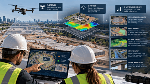
Aerial LiDAR helps solve these problems by capturing dense, measurable three-dimensional data from above. Mounted on drones or aircraft, LiDAR sensors emit laser pulses and measure how long they take to return. Those measurements create a point cloud that can be processed into Digital Terrain Models, Digital Surface Models, contour maps, volume calculations, clearance assessments, CAD-ready files, GIS layers, and 3D visualizations.
AUAV delivers survey-grade drone mapping, aerial survey, LiDAR, inspection, 3D modeling, specialist sensor, and spatial data solutions. Its inSite platform helps teams view, manage, measure, and share large drone and geospatial datasets without relying on static files alone.
Below are seven industries driving aerial LiDAR adoption across the United States and why demand continues to grow.
An aerial LiDAR survey in the U.S. uses laser scanning technology mounted on drones or aircraft to capture accurate three-dimensional terrain, vegetation, and asset data. Transportation, construction, utilities, mining, forestry, environmental management, and industrial infrastructure teams use LiDAR because it can collect detailed elevation information across large, complex, vegetated, or difficult-to-access sites. Unlike standard aerial photography, LiDAR directly measures surface and ground elevation, making it valuable for engineering, planning, inspection, flood modeling, asset management, and digital twin workflows. AUAV delivers survey-grade aerial LiDAR survey solutions alongside drone mapping, inspection, 3D modeling, specialist sensor, and spatial data services, supported by the inSite platform for managing and sharing large geospatial datasets.
Why Aerial LiDAR Adoption Is Growing In The USA
The short answer is that project teams are dealing with more complex environments and tighter timelines than traditional survey methods were built for.
Infrastructure across the U.S. is aging and needs more frequent assessment. Renewable energy corridors are expanding into difficult terrain. Flood resilience programs are demanding elevation accuracy that ground crews struggle to deliver at scale. The common thread across all of it is a need for spatial data that is faster to collect, easier to share, and reliable enough to base real decisions on.
A few specific drivers are pushing adoption forward:
- Aging infrastructure requires inspection and condition data more regularly than before.
- Renewable energy and transmission projects need corridor and terrain data across large, often remote areas.
- Flood and stormwater planning depends on bare-earth elevation models that standard photography cannot provide.
- Construction teams need repeatable survey data to track progress and verify quantities over time.
- Environmental consultants need ground-level terrain data in areas where vegetation blocks everything else.
- Asset owners need datasets that connect directly with CAD, GIS, BIM, and inspection platforms rather than sitting in disconnected files.
Drone-based LiDAR has brought this capability within reach for project types that previously could not justify the cost or logistics of crewed aircraft surveys.
Public programs reflect the same direction. The U.S. Geological Survey’s 3D Elevation Program has been building out national elevation coverage for years. FEMA and NOAA both rely heavily on terrain and coastal data for flood mapping and resilience planning. The commercial sector is following the same logic, just applied to individual project decisions rather than national datasets.
The practical case is straightforward. Better elevation data earlier in a project reduces the kind of uncertainty that leads to design revisions, construction surprises, and compliance headaches later.
Capture Accurate Site Data Before Critical Decisions Begin
Industries Using Aerial LiDAR Survey in USA
1. Transportation And Infrastructure
Transportation agencies, engineering firms, and contractors use aerial LiDAR for highways, rail corridors, bridges, airports, drainage networks, and large civil infrastructure projects.
LiDAR supports:
- Road and rail corridor mapping
- Drainage and grading design
- Bridge and structure context modeling
- Earthwork and embankment monitoring
- Construction progress documentation
- Terrain modeling for design teams
The main advantage is consistency across long, active, or difficult-to-access corridors. Ground surveys remain important for control and validation, but aerial LiDAR can reduce the amount of time teams spend in high-risk or disruptive environments.
Repeatability matters for transportation projects. A project may need data during planning, design, construction, and post-construction verification. Using consistent coordinate systems, survey specifications, and deliverable formats helps teams compare datasets meaningfully over time.
2. Construction And Land Development
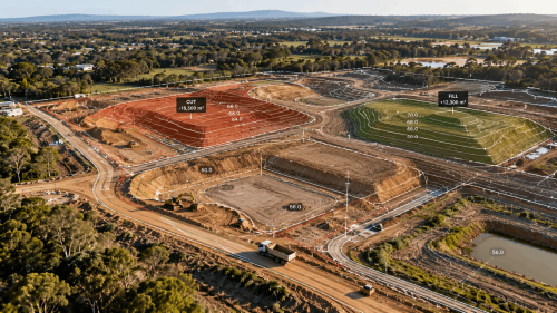
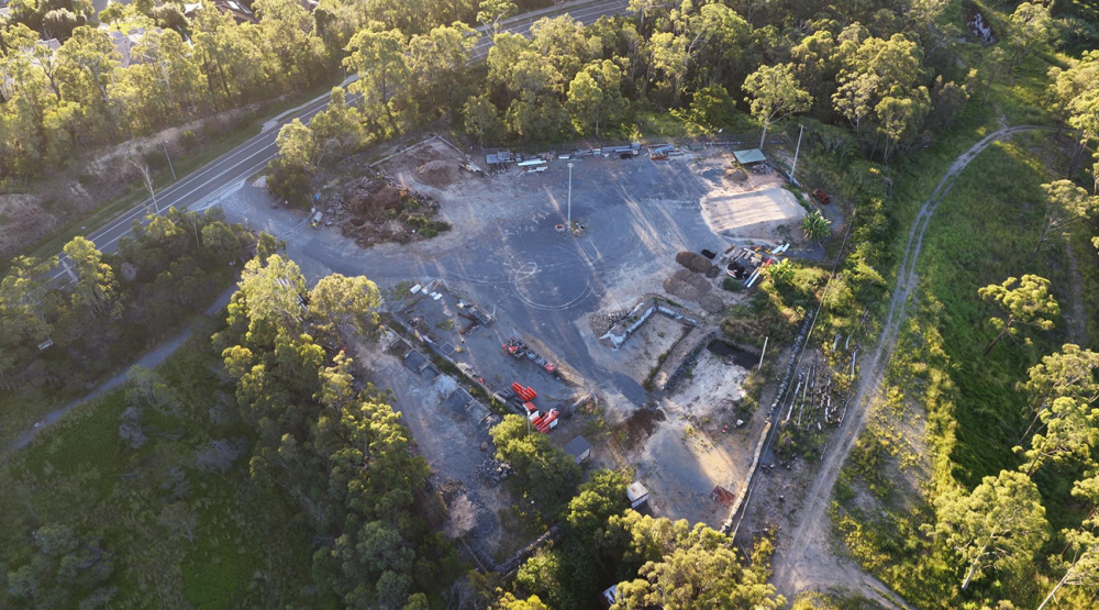
Construction and land development teams need accurate existing-condition data before grading, excavation, design coordination, and site preparation begin.
Drone LiDAR mapping is commonly used for:
- Topographic surveys
- Cut and fill analysis
- Volume calculations
- Earthwork verification
- Progress tracking
- BIM and design coordination
- As-built documentation
The value is not only speed. The bigger advantage is reducing uncertainty before expensive decisions are made. If site models are incomplete, design teams may misjudge slopes, drainage, access, or quantities. LiDAR gives engineers and project managers a clearer picture of real site conditions before work begins.
For construction workflows, deliverable quality is critical. A point cloud alone may not be enough. Teams may need CAD-ready contours, surface models, orthomosaics, or files compatible with Civil 3D, Revit, ArcGIS, or other project platforms.
3. Utilities And Energy
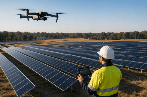
Utility and energy companies manage assets that quite often stretch across remote, vegetated, hazardous, or hard-to-access areas. Aerial LiDAR is especially useful for powerlines, substations, pipelines, solar farms, wind farms, and transmission corridors.
LiDAR helps assess:
- Vegetation encroachment
- Line clearance
- Pole, tower, and structure locations
- Transmission corridor terrain
- Access road condition
- Erosion near critical assets
- Site suitability for renewable energy projects
For utilities, clearance and classification are especially important. The data must distinguish between ground, vegetation, wires, structures, and surrounding terrain. When properly processed, LiDAR supports safer maintenance planning and better asset visibility across the full corridor.
Many utility and energy projects also benefit from combining LiDAR with aerial imagery, thermal data, or visual inspection outputs. That combination creates a more complete view of both terrain and asset condition.
4. Mining And Aggregates
Mining, quarrying, and aggregates operations depend on frequent measurement of changing site conditions. Aerial LiDAR helps teams monitor large, active, and potentially hazardous sites more efficiently.
Common applications include:
- Stockpile volume calculations
- Pit progression tracking
- Haul road assessment
- Slope and terrain monitoring
- Rehabilitation planning
- Environmental compliance support
Repeatability is quite often more important than a single survey for mining teams. Operators need to compare site conditions across weeks, months, or project phases. Consistent survey specifications help teams track production, verify quantities, and monitor rehabilitation progress accurately.
LiDAR also reduces the need for personnel to spend extended time in active operational zones, improving safety while still producing measurable, decision-ready data.
5. Forestry And Natural Resource Management
Forestry is one of the strongest applications for aerial LiDAR because laser pulses can capture ground information through gaps in vegetation. Standard aerial imagery shows canopy and surface appearance. LiDAR can model the terrain beneath trees.
Forestry and natural resource teams use LiDAR for:
- Timber inventory
- Canopy structure analysis
- Biomass estimation
- Forest health monitoring
- Watershed planning
- Wildfire risk assessment
- Habitat and vegetation mapping
This makes LiDAR valuable for government agencies, commercial forestry companies, conservation organizations, and environmental consultants working across large, vegetated landscapes.
The real strength is that LiDAR supports both terrain and vegetation analysis together. That combination helps teams understand not just what a site looks like from above, but how the land and vegetation structure behave together across the full area.
6. Environmental Management And Flood Risk Assessment
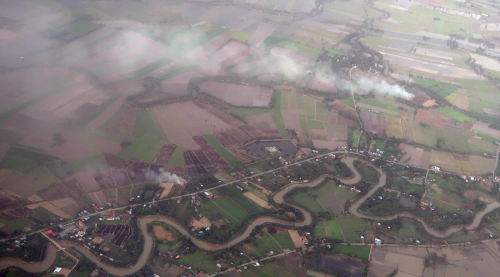
Terrain behaves in ways that are easy to underestimate until a flood model runs on incomplete data. Environmental planners, engineers, hydrologists, and land managers use aerial LiDAR because small elevation differences, ones that ground surveys might not capture consistently across large areas, can significantly change how water moves through a landscape. A floodplain model built on accurate bare-earth data produces different results than one built on surface models that still include vegetation and structures.
LiDAR supports:
- Floodplain mapping
- Wetland restoration planning
- Coastal erosion monitoring
- Watershed analysis
- Stormwater infrastructure design
- Habitat conservation
- Terrain change detection
The bare-earth point is worth dwelling on. Filtering out vegetation and built surfaces to expose true ground elevation is something LiDAR handles well and aerial photography does not. For drainage assessment, stormwater design, and flood resilience work, that distinction shapes how useful the data actually is.
Repeat captures add another layer of value. Coastal sites shift. Restoration projects change the land. Erosion moves material in ways that only show up when you compare datasets across time rather than relying on a single survey. Teams that build regular drone LiDAR captures into their monitoring programs end up with a documented record of change that holds up under regulatory and compliance scrutiny.
7. Oil, Gas, And Industrial Facilities
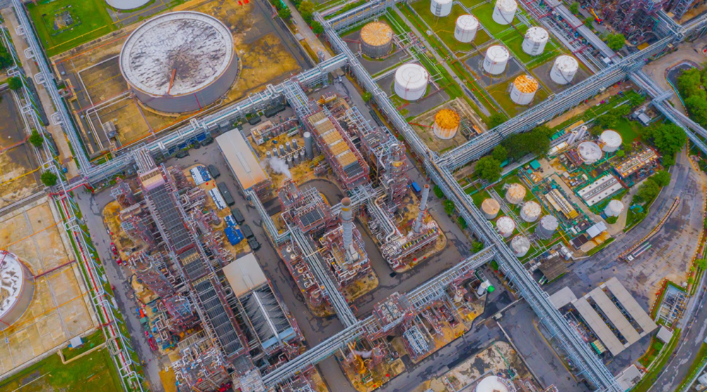
Oil, gas, and industrial operators manage pipelines, processing facilities, terminals, access roads, storage areas, and large operational sites. These environments may be remote, hazardous, sensitive, or difficult to inspect using only ground crews.
Drone LiDAR services can support:
- Pipeline corridor mapping
- Land movement monitoring
- Erosion detection
- Facility expansion planning
- Access road assessment
- Asset management integration
- 3D site visualization
For industrial environments, LiDAR becomes most valuable when the data connects with engineering, inspection, maintenance, or asset management systems. A three-dimensional dataset helps teams understand site layout, plan work, review access constraints, and reduce uncertainty before personnel enter the field.
This is also where data delivery matters. Platforms such as AUAV’s inSite help teams view, measure, annotate, compare, and share large inspection and spatial datasets in a more practical way than static files alone.
Choose Trusted LiDAR Experts For Complex Site Surveys
When Is LiDAR Better Than Aerial Photography?
LiDAR and aerial photography are complementary technologies. Aerial photography is excellent for visual context, inspection images, documentation, and stakeholder communication. LiDAR is stronger when the project depends on elevation, measurement, terrain modeling, vegetation penetration, or three-dimensional outputs.
|
Project Requirement |
LiDAR Survey |
Aerial Photography |
|
Accurate terrain beneath vegetation |
Excellent |
Limited |
|
Engineering-grade elevation models |
Excellent |
Limited |
|
Volume calculations |
Excellent |
Moderate |
|
Construction planning |
Excellent |
Good |
|
Visual marketing imagery |
Limited |
Excellent |
|
Roof or surface condition documentation |
Moderate |
Excellent |
|
Asset visualization |
Good |
Excellent |
|
Digital terrain modeling |
Excellent |
Limited |
|
Flood or drainage modeling |
Excellent |
Limited |
|
Stakeholder visual communication |
Good |
Excellent |
Many projects benefit from using both. LiDAR provides measurable spatial accuracy, while high-resolution imagery adds visual context for engineers, inspectors, project managers, and stakeholders.
What To Consider Before Booking An Aerial LiDAR Survey
A successful LiDAR survey starts before the aircraft leaves the ground. Project teams should define how the data will be used, who will use it, and what format they need.
Key questions include:
- Do you need a point cloud, DTM, DSM, contours, orthomosaic, CAD file, GIS file, BIM-ready output, or inspection portal?
- What accuracy level is required for design, monitoring, compliance, or asset management?
- Does the site include dense vegetation, steep terrain, water features, or restricted access?
- Will the data need to integrate with AutoCAD, Civil 3D, ArcGIS, Revit, Bentley, or an asset management system?
- Is drone LiDAR appropriate, or does the project require crewed aircraft for larger coverage areas?
- Will the site need repeat surveys over time?
- How will stakeholders access, review, measure, and share the final data?
The last question gets overlooked more than any other. Large spatial datasets are only valuable when teams can actually use them. Cloud-based or browser-accessible platforms reduce friction for clients who do not want to manage heavy files or specialist software internally.
Common Mistakes When Procuring LiDAR Surveys
LiDAR projects quite often fall short because of unclear planning, not because of the technology itself.
Common mistakes include:
- Choosing a provider based only on price.
- Forgetting about repeat survey needs.
- Not confirming software compatibility upfront.
- Failing to define deliverables before capture begins.
- Ignoring ground control and accuracy requirements.
- Requesting LiDAR when photogrammetry would be sufficient.
- Underestimating classification and post-processing work.
The strongest LiDAR providers do more than collect data. They help define the right methodology, capture usable data, process it correctly, verify quality, and deliver it in formats that support real project decisions.
Why Work With An Experienced Aerial Mapping Partner?
The value of an aerial LiDAR survey depends on more than the sensor. It depends on planning, flight execution, survey control, data processing, classification, quality assurance, and delivery.
An experienced aerial mapping partner can help:
- Select the right survey method for the project
- Define realistic accuracy requirements
- Plan flights around terrain and site constraints
- Combine LiDAR with imagery or specialist sensors where useful
- Process point clouds into practical deliverables
- Support CAD, GIS, BIM, inspection, or asset workflows
- Deliver data in formats teams can actually use
AUAV’s broader capability across aerial survey, LiDAR, inspection, 3D modeling, specialist sensors, and inSite data delivery makes this especially relevant for complex projects where the final output needs to support engineering, environmental, inspection, or asset management decisions.
Conclusion
Aerial LiDAR survey adoption is growing across the USA because organizations need accurate, repeatable, and practical spatial data for complex projects. Transportation, construction, utilities, mining, forestry, environmental management, and industrial infrastructure all benefit from LiDAR’s ability to capture detailed terrain and asset information across large or difficult sites.
The best results come from matching the survey method to the project objective. Some projects need LiDAR. Others need aerial imagery. Many need both. What matters most is defining the required accuracy, deliverables, software workflow, and long-term data use before the survey begins.
AUAV supports complex mapping, inspection, LiDAR, 3D modeling, and spatial data projects with survey-grade drone technology and practical data delivery workflows. If you are planning a mapping project, contact AUAV to discuss the right aerial LiDAR survey solution for your site, industry, and project goals.
FAQs
What affects the cost of an aerial LiDAR survey?
Site size, terrain complexity, vegetation density, required accuracy, flight method, ground control setup, processing scope, and final deliverable type all factor into pricing. A basic mapping mission over flat, open ground costs considerably less than a large corridor survey requiring LiDAR, classification, volumetric analysis, and formal reporting. Engineering-grade outputs involve more validation and post-processing time than visual documentation.
What deliverables should I request from a LiDAR survey provider?
That depends on what the data needs to do. Common outputs include LAS or LAZ point clouds, Digital Terrain Models, Digital Surface Models, contour maps, orthomosaics, CAD-ready files, GIS-compatible datasets, inspection reports, and browser-accessible viewing platforms. Confirm what your design, compliance, or asset management workflow actually requires before the survey is scoped, not after.
Is drone LiDAR suitable for small projects?
Yes, in many instances. Drone LiDAR is helpful on smaller construction sites, land development projects, utility inspections, environmental surveys, and engineering sites where you need accurate elevation data quickly. Depending on area of coverage, accuracy needs, and timeline, larger corridors or regional programs may require crewed aircraft. The appropriate approach depends on the project, not simply the size of the site.
When is aerial photography better than LiDAR?
When the target is visible. Aerial photography does the job well when it comes to roof condition reviews, general inspections, marketing imagery, stakeholder communication and surface documentation. If the project needs elevation data, terrain modeling, vegetation penetration, volume calculations, clearance measurements or three-dimensional spatial output that photography cannot provide, aerial LiDAR is the better option.
Can LiDAR data be used with CAD, GIS, BIM, or asset management platforms?
Yes, provided the project is scoped with that in mind. LiDAR datasets can be processed into formats compatible with Civil 3D, ArcGIS, Revit, Bentley, and most asset management systems. File formats, coordinate systems, accuracy tolerances, and delivery methods all need to be confirmed before capture begins, not after the data is already in hand.