
Drone LiDAR Survey & Mapping

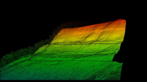
LiDAR (Light, Detection and Ranging) refers to a method of survey data capture whereby a laser is reflected off an object and the response time to the return sensor enables the calculation of the distance. When many thousands of laser pulses occur every second a detailed 3D point cloud of the surroundings can be created.

AUAV have prepared a detailed comparison of the difference between drone aerial LiDAR surveys and those captured using photogrammetric methods. Both methods fall under our broader aerial survey & mapping services, tailored to the needs of your site. Data capture with a drone-based LiDAR is more expensive than that completed with photogrammetry, mostly due to the costs of the sensors and drones that are required to carry them.
There are many sensors on the market at different price points and this can dramatically affect the accuracy of the final data.

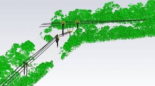
Where LiDAR comes into its own is where there is dense vegetation as the laser pulse will be more able to reach the ground compared to the photogrammetry derived survey model.

For more information on asset inspection in your specific area of interest, read our LiDAR industries article, or contact us to discuss your needs.

Typical Cost-Effective Uses of LiDAR Includes

  • Survey of land under dense vegetation.
  • Assisting in the 3D modelling of complex or shiny structures.
  • Identifying vegetation encroachment into powerline corridors.
  • Catenary analysis of conductors.
  • Covering large areas where the data is needed quickly after capture.

Frequently Asked Questions

The best survey method depends on your site conditions, project objectives, required accuracy, and final deliverables. An aerial LiDAR survey in the USA is often recommended for projects involving dense vegetation, complex terrain, or where highly detailed elevation data is needed.

Drone LiDAR services are commonly used for infrastructure planning, utility corridors, mining, land development, forestry, transportation, environmental studies, and engineering projects. They are particularly valuable where accurate terrain and surface information is required over large or difficult-to-access areas.

Every project begins with a review of your survey objectives and site conditions. After flight planning and data capture, the collected information is processed, quality checked, and converted into the required mapping and modelling deliverables before being supplied in the agreed format.

Yes. Unlike image-based surveys, laser pulses can often pass through gaps in vegetation to capture ground elevations. This makes UAV LiDAR mapping a practical choice for projects where tree cover limits the effectiveness of conventional aerial survey methods.

Depending on your project requirements, deliverables may include classified point clouds, digital terrain models (DTMs), digital surface models (DSMs), contour mapping, CAD files, GIS-ready datasets, and a drone LiDAR point cloud for further engineering or spatial analysis.

Survey accuracy depends on several factors, including the sensor used, flight planning, site conditions, and processing methodology. Working with an experienced LiDAR survey company helps deliver reliable data that meets your project's technical and operational requirements.

Yes. Drone LiDAR is an efficient solution for surveying extensive sites, transport corridors, utility networks, and challenging landscapes. Where appropriate, airborne LiDAR scanning can capture consistent, high-density data across large areas while reducing the time required for traditional field surveys.

LiDAR can significantly reduce the need for manual data collection across many projects by capturing millions of measurement points from the air. Depending on project specifications, some ground verification may still be required to validate survey accuracy.

Project duration depends on the size of the survey area, terrain complexity, weather conditions, and required deliverables. While data capture is often completed quickly, processing and quality assurance are equally important to produce accurate survey outputs.

Yes. Accurate terrain and spatial datasets can be used throughout the lifecycle of a project, supporting design, construction, environmental monitoring, maintenance planning, and future change detection. A LiDAR terrain mapping drone provides consistent data that can be compared over time to monitor site conditions.

Get in touch with us today