
At AUAV we specialize in utilizing the latest drone technology to perform comprehensive crack mapping of dams. Dams play a critical role in water management and energy generation, but over time, cracks can develop, posing potential risks to the structural integrity of these vital structures.
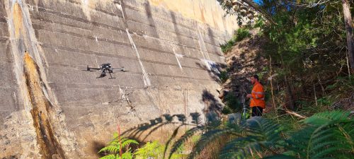
Crack Mapping of Dams
Our advanced drone-based crack mapping solutions provide accurate and efficient assessments, ensuring the safety and reliability of dams.
Why Choose Drone-Based Crack Mapping?
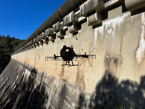
1. Precision and Accuracy: Our drones are equipped with high-resolution cameras and sensors, enabling us to capture detailed images and data of the dam’s surface. This allows for precise identification and measurement of cracks, even in hard-to-reach areas.
2. Enhanced Safety: Traditional crack mapping methods often involve manual inspections, which can be time-consuming and hazardous for inspectors. With our drone technology, we can access challenging locations without endangering human lives, reducing the risk of accidents and injuries.
3. Time and Cost Efficiency: By employing drones, we streamline the crack mapping process, significantly reducing the time required for inspections. This leads to cost savings for our clients while maintaining the quality and accuracy of the assessment.
4. Comprehensive Reporting: Our team of experts utilizes advanced software tools to analyse the collected data and generate detailed reports. These reports provide an in-depth understanding of the dam’s condition, highlighting the location, extent, and severity of cracks, along with recommendations for necessary repairs or maintenance.
5. Regular Monitoring: Dams are subject to constant environmental and operational factors that can impact their structural integrity. Our drone-based crack mapping services can be employed for regular monitoring, allowing for early detection of cracks and proactive maintenance, minimizing the potential for catastrophic failures.
We are committed to delivering reliable, data-driven solutions for dam safety. Our team of experienced professionals combines expertise in drones, and imaging technology, to provide accurate and actionable insights.
Frequently Asked Questions
A drone captures high-resolution imagery of the dam surface, allowing detailed areas to be reviewed for visible cracking. Drone crack detection can help identify and document cracks in locations that may be difficult or hazardous for inspectors to access manually.
High-resolution imagery and collected inspection data can be analysed using specialist software to identify the location, extent, and severity of cracks. UAV structural crack mapping can provide a visual record of these findings for assessment, reporting, and future monitoring.
Yes. Drone-based crack mapping can be used as part of regular monitoring programs. Repeated inspections can provide comparable records of the dam's surface condition, helping identify changes in cracking over time and supporting proactive maintenance.
Yes. Drone technology can capture imagery from challenging locations without requiring inspectors to physically access every area of the dam surface. This can be particularly useful where conventional access would involve additional safety risks or logistical requirements.
Reports can document the location, extent, and severity of identified cracks, together with relevant inspection findings and recommendations for repairs or maintenance. The collected imagery and analysis provide supporting information for understanding the dam's condition.
Detailed inspection records can help asset owners understand where cracking is present and whether areas require further attention. Regular data collection can also provide information for comparing conditions over time and planning appropriate maintenance activities.
AUAV provides drone-based inspection and data collection services, and its US operations support commercial and industrial projects. For a dam inspection drone in the USA, the scope can be assessed based on the dam, inspection objectives, site conditions, and required data.
Drone imagery provides detailed visual information about surface conditions, but the appropriate use of the data depends on the inspection objective and assessment requirements. Drone-based mapping can provide valuable evidence for identifying and documenting cracking, while further assessment may be appropriate where required.